Shenandoah Valley National Park, Front Royal, VA, US - 0 Pictures
America East to West. We visit, We record, We present, You Enjoy! More
These are 13 yrs 6 mths Old Memories. Old is Gold. People may change, feelings & memories don’t


OurTripVideos Image Full View
Title

Comments Hotels
Car
Restaurants
Attractions
Directions
Weather
http://www.nps.gov/shen/ - Shenandoah National Park - National Park Service
http://www.nps.gov/shen/ - Shenandoah National Park - National Park Service
Details - Published on 09/27/2010 - Views : 16994 ( + More Social Media views )
Gazing across the horizon from the peaks of Shenandoah National Park it is hard to believe you are just 75 miles from the bustle of our nations capital. Take Skyline Drive along the crest of the mountains through the woods and past spectacular vistas. Hike in the shade of oak trees along the Appalachian Trail, discover the stories from Shenandoahs past, or just relax in the wonder of wilderness.
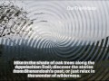
Fall in Shenandoah
It is that time again! The crisp days of late September and October are here and Shenandoah is the place to be. Cooler temps bring all kinds of changes as the animals get ready for winter, and trees and fall wildflowers put on the show of the year.
There are four entrances into Shenandoah National Park and numerous gateway communities that offer services. The parks four entrances are located at:
Front Royal, accessible via I-66 and Route 340.
Thornton Gap, accessible via Route 211.
Swift Run Gap, accessible via Route 33.
Rockfish Gap, accessible via I-64 and Route 250(Rockfish Gap is also the northern entrance to the Blue Ridge Parkway).
Shenandoah National Park has over 500 miles of trails, including 101 miles of the Appalachian Trail. Many trails are accessed from Skyline Drive. Some short trails lead to a waterfall or viewpoint; longer and more difficult trails penetrate deep into the forest and wilderness.
The Skyline Drive runs 105 miles north and south along the crest of the Blue Ridge Mountains in Shenandoah National Park and is the only public road through the park. It takes about three hours to travel the entire length of the park on a clear day.
As you travel along Skyline Drive you will notice mileposts on the west side (right side if you are traveling south) of the road. These posts help you find your way through the park and help you locate areas of interest. The mileposts begin with 0.0 at Front Royal and continue to 105 at the southern end of the park. The largest developed area, Big Meadows, is near the center of the park, at milepost 51. All park maps and information use these mileposts as a reference.
The maximum speed limit is 35 mph, so you can roll down your windows, feel the breeze and experience every curve and turn of this beautiful drive. There are 75 overlooks that offer stunning views of the Shenandoah Valley to the west or the rolling piedmont to the east.
Deer, black bear, wild turkey, and a host of other woodland animals call Shenandoah home and regularly cross Skyline Drive in their daily travels.
RVs, camping trailers, and horse trailers are welcome, but be prepared to shift into low gear. Also, be sure you will clear Marys Rock Tunnel (just south of Thornton Gap entrance from Route 211) at 12 8.
>City(s) = Shenandoah National Park, Front Royal; State(s) = VA; Country = USA.
>Title = Shenandoah Valley National Park, Front Royal, VA, US - Video.
>Keywords = Shenandoah National Park, Front Royal, VA, US, Skyline Drive, mountains, spectacular vistas, Appalachian Trail, Fall, Sept, Oct, winter, trees, wildflowers, Thornton Gap, Swift Run, Rockfish, Blue Ridge Parkway, waterfall viewpoint, ourtripvideos, our, trip, videos, crlapindfrn (225)
>Catg =
 FOG Holi - Celebrate Festival of Co . . .
  HCCC Human Services - Annual Senior . . .
  FOG - Ram Mandir Inauguration Celeb . . .
  Bhagavad Gita Virat Parayanam - JET . . .
  FOG - Garba of Gujarat - UNESCO - I . . .
  FOG Diwali at ICC, Milpitas, CA, US . . .
  Sri Ashta Lakshmi Temple, Fremont, . . .
  Wat Dhammararam Buddhist Cambodian . . .
  Shiva-Vishnu Temple, Stockton, CA, . . .
  FOG Holi - Festival of Colors, Frem . . .
 , Milpitas, CA, USA - Online News Paper RSS - views") TTD Sri Srinivasa Kalyanam by SVCC . . .
TTD Sri Srinivasa Kalyanam by SVCC . . .  FOG Diwali - Festival of Lights, Fr . . .
  FOG India Day Parade and Fair, Frem . . .
  FOG India Republic day, Fremont, CA . . .
  Sri Chakra Puja, Anugraha Bhashanam . . .